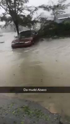
This was just sent to me from a Canadian whose parents are in the Abacos Islands in the Bahamas where Category 5, Hurricane Dorian has made landfall. This video was taken this morning.
The National Hurricane Centre says to expect “catastrophic conditions”
Hurricane Dorian struck the northern Bahamas as a catastrophic Category 5 storm Sunday, its record 295 km/h winds ripping off roofs, overturning cars and tearing down power lines as hundreds hunkered down in schools, churches and shelters.
Dorian slammed into Elbow Cay in Abaco island at 12:40 p.m. ET, and then made a second landfall near Marsh Harbour at 2 p.m., after authorities made last-minute pleas for those in low-lying areas to evacuate.
"It's devastating," said Joy Jibrilu, director general of the Bahamas' Ministry of Tourism and Aviation. "There has been huge damage to property and infrastructure. Luckily, no loss of life reported."
With its maximum sustained winds of 295 km/h and gusts up to 350 km/h, Dorian tied the record for the most powerful Atlantic hurricane ever to come ashore, equalling the Labor Day hurricane of 1935, before the storms were named.
There were indications that the slow-moving Dorian would veer sharply northeastward after passing the Bahamas and track up the U.S. Southeast seaboard. But authorities warned that even if its core did not make U.S. landfall, the potent storm would likely hammer the coast with powerful winds and heavy surf.
South Carolina Gov. Henry McMaster ordered a mandatory evacuation of the entire coast of the state amid Dorian's threat. The order, which covers about 830,000 people, goes into effect at noon Monday, when state troopers will begin reversing lanes so they all head inland on major coastal highways.
"We can't make everybody happy," McMaster said. "But we believe we can keep everyone alive."
Georgia's governor, Brian Kemp, later ordered mandatory evacuations of that state's Atlantic coast, also starting at midday Monday.
Authorities in Florida also ordered mandatory evacuations in some vulnerable coastal areas.
Global Affairs is advising Canadians to avoid all non-essential travel to Florida and avoid all travel to the Bahamas.
'Catastrophic conditions'
The only recorded storm that was more powerful was Hurricane Allen in 1980, with 305 km/h winds. That storm did not make landfall at the strength.
"Catastrophic conditions" were reported in Abaco, with a storm surge of 5-7 metres, and Dorian was expected to cross Grand Bahama later in the day "with all its fury," the centre said. The hurricane was moving to the west at 8 km/h.
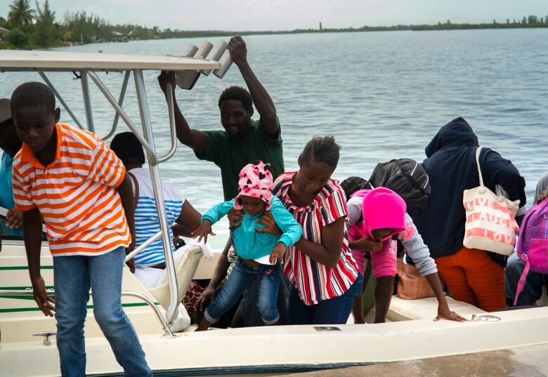
In the northern stretches of the archipelago, hotels closed, residents boarded up homes and officials hired boats to move people to bigger islands.
Video that Jibrilu and government spokesman Kevin Harris said was sent by Abaco residents showed homes missing parts of their roofs, downed power lines and smashed and overturned cars. One showed floodwaters rushing through the streets of an unidentified town at nearly the height of a car roof.
In some parts of Abaco, "you cannot tell the difference as to the beginning of the street versus where the ocean begins," said Prime Minister Hubert Minnis.
According to the Nassau Guardian, he called it "probably the most sad and worst day of my life to address the Bahamian people."
Earlier, Minnis had warned that anyone who did not evacuate was "in extreme danger and can expect a catastrophic consequence."
The government opened 14 shelters across the Bahamas. Dozens ignored evacuation orders, officials said.
"The end could be fatal," said Samuel Butler, assistant police commissioner. "We ask you, we beg you, we plead with you to get to a place of safety."
Bahamas radio station ZNS Bahamas reported a mother and child in Grand Bahama called to say they were sheltering in a closet and seeking help from police.
Silbert Mills, owner of the Bahamas Christian Network, said trees and power lines were torn down in Abaco.
"The winds are howling like we've never, ever experienced before," said Mills, 59, who planned to ride out the hurricane with his family in the concrete home he built 41 years ago in central Abaco.
'You prepare for the worst'
Earlier Saturday, skiffs shuttled between outlying fishing villages and McLean's Town, a settlement of a few dozen homes at the eastern end of Grand Bahama island, about 240 kilometres from Florida's Atlantic coast. Most came from Sweetings Cay.
"They said evacuate, you have to evacuate," said Margaret Bassett, a ferry boat driver for the Deep Water Cay resort.
But Jack Pittard, a 76-year-old American who has visited the Bahamas for 40 years, decided to ride out the storm — his first hurricane — in Abaco.
He said he battened down his house to spend the storm in a nearby duplex. He noted the ocean is quite deep near where he was staying, and there is a cay that provides protection.
A short video from Pittard about 2:30 p.m. showed winds shaking his home and ripping off its siding.
Jeffrey Allen, who lives in Freeport on Grand Bahama, said he had learned after several storms that damage predictions sometimes don't materialize, but he still takes precautions.
"It's almost as if you wait with anticipation, hoping that it's never as bad as they say it will be. However, you prepare for the worst nonetheless," he said.
Over two or three days, the hurricane could dump as much as a metre of rain, in addition to the winds and storm surge, said private meteorologist Ryan Maue.
Harris, the government spokesman, said Dorian could affect 73,000 residents and 21,000 homes. Authorities closed airports for Abaco, Grand Bahama and Bimini, but Lynden Pindling International Airport in the capital of Nassau stayed open.
The archipelago is no stranger to hurricanes. Homes are required to have metal reinforcements for roof beams to withstand winds into the upper limits of a Category 4 hurricane, and compliance is generally tight for those who can afford it. Risks are higher in poorer neighbourhoods, with wooden homes in low-lying areas.
U.S. braces for Dorian
After the Bahamas, the slow-crawling storm was forecast to turn sharply and skirt toward the U.S. coast, staying just off Florida and Georgia on Tuesday and Wednesday and then buffeting South Carolina and North Carolina on Thursday.
The National Hurricane Center issued a hurricane watch for Florida's East Coast from Deerfield Beach north to the Volusia and Brevard county line. The same area was put under a storm surge watch. Lake Okeechobee was under a tropical storm watch.
Florida Gov. Ron DeSantis warned the state's densely populated Atlantic coast: "We're not out of the woods yet."
He suspended tolls on the Florida Turnpike and other roads, including Alligator Alley, from Fort Lauderdale to Naples, to keep traffic flowing for evacuees.
DeSantis noted some forecast models still bring Dorian close to or even onto the Florida peninsula.
"That could produce life-threatening storm surge and hurricane force winds," DeSantis said. "That cone of uncertainty still includes a lot of areas on the east coast of Florida and even into central and north Florida, so we are staying prepared and remaining vigilant."
Palm Beach County ordered a mandatory evacuation for the eastern half of the county as of 1 p.m. Sunday. That included mobile homes, substandard housing, low-lying areas prone to flooding and homes along the Intracoastal Waterway and on barrier islands.
For Florida, it could come down to a handful of miles between relative safety and potential devastation. On Tuesday and Wednesday, Dorian is forecast to be 60 to 80 kilometres off the Florida with hurricane-force wind speeds extending about 35 miles to the west.
National Hurricane Center Director Ken Graham urged residents not to bet on safety just because the specific forecast track has the storm just a bit offshore. Don't focus on the track, he said, but the larger cone of possibility that includes landfall.
Complicating matters is that with every new forecast, "we keep nudging (Dorian's track) a little bit to the left" which is closer to the Florida coast, Graham said.
Dorian is a powerful but small storm with hurricane force winds Sunday only extending 47 kilometres to the west, but they are expected to grow a bit. That makes forecasting its path delicate and difficult.
President Donald Trump already declared a state of emergency and was briefed about what he called a "monstrous" storm.
"We don't know where it's going to hit but we have an idea, probably a little bit different than the original course," Trump said. "But it can change its course again and it can go back more toward Florida."
North Carolina Gov. Roy Cooper said the state could see heavy rain, winds and floods.
The hurricane upended some Labour Day holiday weekend plans in the U.S.: Major airlines allowed travelers to change reservations without fees, big cruise lines rerouted their ships and Cumberland Island National Seashore off Georgia closed to visitors. Disney World and Orlando's other resorts held off announcing any closings.


